
When there was a Live and Learn conference in Albuquerque a few years ago, the hotel was not far from the train station, and a quick freeway drive to the airport, and Old Town and the museums were right out the side door.
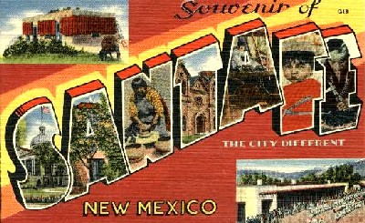
Santa Fe is different. Their nickname/slogan is "The City Different," or used to be anyway. (Click the card for some Santa Fe history and trivia.)
More about Santa Fe, from the city's official site: http://santafe.org/
including this news item: American Eagle offers nonstop daily flights between Dallas and Santa Fe starting June 11, 2009!
The place we'll be staying would send a van the 65 miles to the Albuquerque airport to get you, if you went in summer and paid full price during tourist season. We're using discounted, off-season winter rates, with another discount. So that's good! But as to walking there from a train station, that's not happening.
So the best way to attend this gathering will be to drive there. The second best way would be fly to Albuquerque and rent a car. That drive only takes an hour or so. Or for the adventurous winter sportsmen type, maybe fly to Denver or Colorado Springs and rent a car, if you want to see some mountains. If a great deal of snow is seeing the mountains at the same time, it might be difficult to get to Santa Fe. It's rarely impossible, and Raton Pass (sounds like "rahTONE") is rarely closed longer than half a day, when it's closed. I-25 is a reliable corridor.
Because of all this, it's probably a better idea for those from the western U.S., in general, than for New Englanders and that. On the other hand, for a family that's never seen the mountains or has wanted a good excuse to go to Santa Fe, here you go!
Because anyone who can see this page can also get to google maps and mapquest, I don't feel too bad about providing an imperfect map. The red lines are the freeways and highways. Denver to Albuquerque, that's I-25.
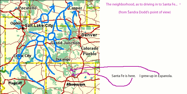


I forgot to say what the fat blue lines are on that map. It's where the water drained in the Eocene days. I didn't find another map with the Denver-to-Albuquerque stretch of I-25. So thanks to Bill Butler's report on the paleogeography of the Colorado River, I found a map.
ReplyDeleteIn a later post I'll send exact coordinates for the site, so you can find it on Google Earth if you want to. I'd like to sign the contract before I name more names, but things look really wonderful.